Services Built for AEC Professionals
From field capture to final deliverable — we handle every step of the reality capture workflow with survey-grade precision and project-ready outputs.
One workflow. Every deliverable.
Gemini Reality Capture combines survey-grade hardware with experienced technicians and rigorous QA to deliver point clouds, BIM models, and drawings your team can trust from day one. We work directly with architects, engineers, contractors, and facility managers across the United States.
Our Services
Full-Spectrum Reality Capture
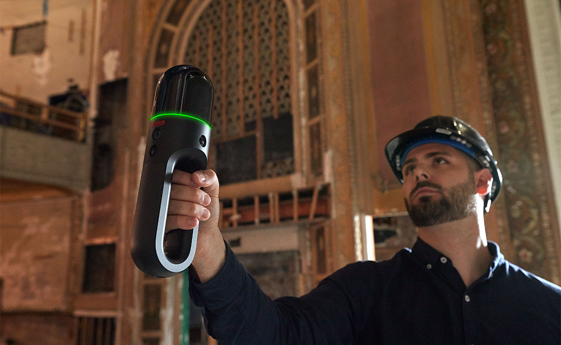
3D Laser Scanning
Millimeter-accurate capture of any structure or site.
We deploy survey-grade terrestrial laser scanners to capture dense, accurate 3D point clouds of buildings, facilities, and sites of any scale. Every scan is registered, quality-checked, and delivered in your preferred format.
- Interior and exterior building capture
- Large-scale industrial and infrastructure sites
- Multi-floor and multi-building campaigns
- Colorized point clouds from integrated photography
- Georeferenced to local or national coordinate systems
Aerial Scanning
UAV-mounted LiDAR and photogrammetry for large-scale sites.
We deploy UAV-mounted LiDAR sensors and photogrammetry systems to capture terrain, structures, and infrastructure from the air. Aerial scanning dramatically reduces field time on large or difficult-to-access sites while delivering survey-grade accuracy and dense, colorized point clouds.
- UAV LiDAR for terrain and structural capture
- Photogrammetry for high-resolution orthomosaics and 3D models
- Large-scale site, corridor, and infrastructure surveys
- Access to rooftops, facades, and hazardous areas without scaffolding
- Georeferenced outputs tied to ground control points
- FAA Part 107 certified operations
As-Built Surveys
Accurate documentation of existing conditions.
Our as-built surveys capture the true state of a building or facility — not the design intent. We document walls, columns, MEP systems, floor levels, and structural elements with the precision renovation and retrofit projects demand.
- Existing conditions documentation for renovation
- Tenant improvement and fit-out projects
- Facility management and space planning
- Clash detection support for MEP coordination
- Comparison of as-built vs. design drawings
BIM / Revit Modeling
Scan-to-BIM models ready for design and construction.
We convert point cloud data into fully coordinated Revit models at LOD 200 through LOD 400. Our BIM deliverables are built to your project's specific requirements and are ready to hand off to your design team on day one.
- LOD 200 through LOD 400 modeling
- Architectural, structural, and MEP systems
- Fully coordinated multi-discipline models
- Clash detection and coordination support
- Custom family creation and content
Point Cloud Processing
Clean, registered, and delivery-ready scan data.
We take raw scan data from any scanner and deliver clean, registered, and optimized point clouds in every major format. Whether you captured the data yourself or need us to process a third-party dataset, we handle the full processing workflow.
- Multi-scan registration and alignment
- Noise filtering and outlier removal
- Colorization from photography
- Classification and segmentation
- Format conversion and optimization
Floor Plans & Elevations
Precise 2D drawings extracted from 3D scan data.
We extract dimensionally accurate floor plans, reflected ceiling plans, building sections, and elevations directly from point cloud data. Every line is measured, not estimated — giving you drawings you can build from.
- Floor plans at any scale
- Reflected ceiling plans
- Building sections and elevations
- Dimensioned and annotated drawings
- Existing conditions and demo plans
Virtual Production
Gaussian Splats, VR-ready assets, and real-world environments for film and game engines.
We capture real-world locations and structures and deliver them as photorealistic 3D assets ready for virtual production pipelines. From Gaussian Splats for LED volume stages to Unreal Engine-ready environments and VR-ready point clouds, we bridge the physical and digital worlds with survey-grade precision.
- Gaussian Splat capture for LED volume and virtual production stages
- Unreal Engine 5 ready environments via LiDAR and photogrammetry
- VR-ready assets for Meta Quest, Varjo, and enterprise headsets
- High-density colorized point clouds for real-time rendering
- Location scouting and pre-visualization capture
- Integration with Luma AI, Polycam, and RealityCapture pipelines
Deliverable Formats
Topographic Surveys
Ground surface mapping for civil and site design.
We capture ground surface topography, site features, and utility infrastructure using a combination of terrestrial scanning and total station survey. Deliverables are georeferenced and ready for civil engineering and site design workflows.
- Ground surface and contour mapping
- Site feature documentation
- Utility and infrastructure mapping
- Georeferenced to local or national datum
- Integration with civil design software
Deliverables
Every Format Your Team Needs
We deliver in all major point cloud, BIM, and CAD formats — so your team can get to work immediately without format conversion or data wrangling.

From raw scan data to construction-ready BIM — in days, not weeks.
Our Process
How It Works
Scope & Proposal
Tell us about your project — building type, size, deliverables needed, and timeline. We'll review your details and respond within one business day.
Field Capture
Our crew mobilizes to your site with survey-grade scanners. We work efficiently to minimize disruption, capturing every space with the density your deliverables require.
Processing & QA
Raw scan data is registered, cleaned, and quality-checked in our office. Every dataset is reviewed against our accuracy standards before we begin deliverable production.
Deliverable Production
We produce your point clouds, BIM models, or drawings to your exact specifications — LOD, layer standards, coordinate systems, and file formats.
Delivery & Support
Deliverables are uploaded to a secure project portal. We stay available for questions, revisions, and follow-up scans throughout your project.
Get Started
Ready to Start Your Project?
Tell us what you need and we'll review your details and respond within one business day.